Do you need to achieve centimeter-level accuracy in your topographic, agricultural, or environmental surveys? In this article, you’ll discover what a Base + Rover GNSS system is, why it’s essential for professional surveys, and how it works in practice. From the difference between base and rover, to the methods for transmitting RTK corrections, and the step-by-step configuration using simple devices like ProTRACK.
A complete overview for working reliably, even without an internet connection.
Why do you need a Base + Rover GNSS system?
Have you ever tried surveying with a basic GPS and noticed the results were far from accurate? Maybe you ended up with points off by several meters and with data unusable for a technical project. In such cases, you’ve probably asked yourself if there’s a way to achieve centimeter-level accuracy.
The most common answer to this need is called a Base + Rover GNSS system.
A standard GNSS receiver, if used alone and without corrections, has an accuracy range of 1 to 3 meters and, in unfavorable conditions, even worse. If your job requires knowing the position with a maximum error of just a few centimeters, then you need something more advanced: an RTK system using the Base + Rover configuration.
In short, it consists of two GNSS devices working together: one (the base) remains fixed on a known point and transmits corrections; the other (the rover) moves and receives these corrections to improve its position in real time.
What is a GNSS Base and what is a Rover?
In detail:
The GNSS Base is a receiver placed on a fixed point (ideally known with exact coordinates) that transmits correction data in real time.
The GNSS Rover is the mobile receiver that receives these corrections and calculates its position with an error margin of just a few centimeters.
The connection between the two can occur via:
- Radio link (e.g., LoRa)
- TCP/IP connection
- Private or public NTRIP networks
When to use a Base + Rover system
This configuration is recommended in all situations where high precision and independence from mobile networks are required. Here are some typical applications:
- Topography
For cadastral surveys, elevation plans, subdivisions, contour lines, etc. - Precision agriculture
To geolocate plots, manage seeding, treatments, and harvesting. - Environmental monitoring
For tracking in areas affected by erosion, landslides, or ground movement. - Surveys via vehicles or drones
For mobile applications: road surveys, rooftop or infrastructure surveys with rovers mounted on cars or RTK drones.
Discover how to configure a dynamic Base + Rover system from a vehicle
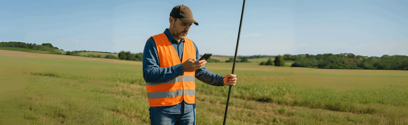
ProTRACK in a Base + Rover configuration
If you’re looking for a simple, portable, and multi-frequency solution, ProTRACK is an ideal tool.
Thanks to the BaseQui function, it’s possible to dynamically reposition the GNSS base in the field to progressively extend the survey area, maintaining a stable and accurate differential correction.
This solution is perfect for operations in remote areas, agricultural zones, mountain sites, or any location without available connectivity.
The configuration is done through the Analist Mobile app, which allows you to:
- 1. Select the operating mode (Base or Rover)
- 2. Start the local network for correction transmission
- 3. Monitor device and connection status
Watch how to configure it step-by-step
In the video below, we show you exactly how to configure the Base + Rover GNSS system using ProTRACK and the Analist Mobile app.
Watch the full video to learn every step of the field configuration.
Now that you understand what a Base + Rover GNSS system is, what it’s for, and how to configure it, all that’s left is to put it into practice. Whether you need to perform a topographic survey, map agricultural boundaries, or monitor an environmentally at-risk area, this technology guarantees the accuracy you need.
And if you’re looking for a solution that combines reliability, simplicity, and portability, devices like ProTRACK allow you to work even without an internet connection or complex networks.
You’ll be up and running in minutes, with professional results at your fingertips.