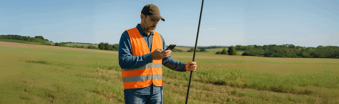
If you work in the environmental field or you need to monitor landslides, trails, or watercourses, you know how challenging it can be to carry out accurate surveys in remote areas. Cell signal is often unstable, the terrain is hard to access, and traditional methods are no longer enough.
That’s why today, specific tools for environmental GPS surveying are used—capable of recording points with centimeter-level precision even where there’s no connection. We’ll explain in simple terms how environmental monitoring with GPS works, the most common field difficulties, and how to overcome them.
We’ll also see how to use ProTRACK, a professional GPS designed for those working in nature: lightweight, rugged, and capable of operating even without network thanks to the Base + Rover mode.
Whether you’re a technician, a hiker, or a civil protection worker, here you’ll find everything you need to work safely and without errors.
If you work in the mountains, in a forest, or near a river to monitor landslides, trails, or areas at risk of soil erosion, you already know how difficult it is to perform accurate surveys.
Phone signal is often weak or non-existent, the terrain is uneven, and having complex instruments only makes things worse.
Luckily, there is a simple solution: it’s called ProTRACK, the professional GPS that helps you work safely even where there’s no Internet.
In this article, we’ll show you how environmental GPS surveying works, the challenges in the field, and why ProTRACK is useful even if you’re not an expert technician.
What is GPS used for in natural environments?
When you need to inspect a landslide, monitor a trail, or track soil erosion, it’s crucial to return to the exact same spot, with precision.
With a professional GPS you can:
- Save the exact coordinates of a point;
- Compare data after months or years;
- Understand whether and how much the ground has shifted.
This type of surveying is called environmental monitoring and it’s increasingly common in parks, forests, or along rivers.
How environmental GPS surveying works
Each time you record a point, the system saves latitude, longitude, altitude, and time: these data can be compared with those from previous or future surveys.
The process is simple: you walk through the area to be surveyed and collect points deemed important. Once the work is complete, the data can be downloaded and used in mapping software, GIS, or CAD or BIM.
In this context, using the ProTRACK GPS, you can import the data into Analist CLOUD, the software powered by Autodesk Technology that lets you process the acquired data into, for example, maps and 3D models.
What are the challenges in the field?
Doing GPS surveys in nature isn’t like working in a city.
You may face tough conditions, for example:
- You’re in the mountains and there’s no phone signal;
- The terrain is slippery or difficult, so you need to move carefully.
In these cases, it’s essential to have a lightweight tool that works even without Internet.
Why a reliable GPS is necessary
When you’re in a landslide-risk area or a spot frequented by hikers, you can’t afford mistakes. If your GPS fails, you lose the collected data. And most importantly, you’d have to redo everything from scratch.
A mistake can mean:
- Incorrect data leading to wrong decisions;
- Surveys to be repeated, resulting in lost time and effort;
- Compromised safety—for you and for others passing through.
ProTRACK: the GPS that works even in the woods
If you need to survey a landslide in the mountains or a trail in the middle of the woods, you probably already know that your phone may have reception issues: that’s why you need a GPS that can work offline. One such device is ProTRACK.
It weighs only 850 grams, so you can carry it easily in your backpack. Moreover, it’s water- and shock-resistant. It operates in Base + Rover mode, meaning it creates its own local GPS network: this allows you to continue surveying accurately even where there’s no mobile network.
With the app on your phone, you can:
- View collected points directly on the map;
- Follow a trail;
- Save the data for use on your computer.
And if there’s no Internet?
You don’t need it. ProTRACK is designed specifically for those who work outside network coverage. Thanks to the Base + Rover mode, you can work even in the mountains, forests, or along a river.
This function is ideal for:
- Landslide and collapse surveys;
- Erosion monitoring on coasts or embankments;
- Trail or protected area monitoring.
If you work in environmental monitoring, surveying, or land management, having a simple and accurate tool can save you time and prevent mistakes.
ProTRACK is the ideal work companion for those who need a GPS that always works—even without Internet.
And thanks to Analist CLOUD, you can manage, process, and share all the collected information easily, integrating it into your projects.
Whether you need to map a trail, monitor a landslide, or survey a high-risk area, with ProTRACK you can do it easily and safely.