Drone surveys have become a key tool for acquiring accurate topographic data in a short time. But to achieve professional-level accuracy, you need a system capable of correcting GPS signal errors in real time. That’s where the RTK base comes into play. Until recently, these technologies were complex and reserved for expert surveyors. Today, thanks to intuitive solutions like ProTRACK, even less experienced professionals can achieve centimeter-level results with ease. If you’re looking for a lightweight, affordable, and easy-to-use RTK GPS, this guide will help you understand how ProTRACK works and why it’s the right choice for your drone surveys.
If you’re thinking about using a drone for topographic, photogrammetric, or agricultural surveys, you may have already encountered terms like RTK, GNSS base, differential corrections, or centimeter-level accuracy. And maybe you’ve asked yourself: “Do I really need all this equipment to work effectively?”
The answer is yes — but with good news: today, there are lighter, more intuitive, and accessible solutions, like the ProTRACK GPS by Analist Group, which allows you to achieve the same professional precision even if you’re not an expert surveyor.
In this article, you’ll discover what an RTK base for DJI drones is, what it’s used for, and how you can use it easily.
Why a drone alone isn’t enough for accurate surveys
The latest-generation drones, such as the DJI Mavic 3 Enterprise RTK or Matrice 350 RTK, are powerful tools: they capture ultra-high-resolution photos, cover large areas, and enable the creation of 3D terrain models, orthophotos, and digital maps.
However, there’s a limitation: the standard GPS position received by the drone from satellites can have errors of several meters. That’s fine for a video or tourist photo — but not accurate enough for drone and GPS-based surveys.
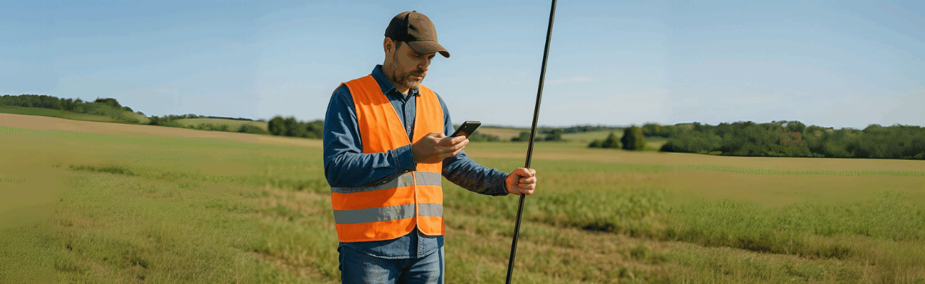
What is an RTK base and why you need one
To obtain centimeter-level precision, you need a system called RTK (Real-Time Kinematic). This system is based on two GNSS receivers:
- one on board the drone (RTK rover)
- one fixed on the ground (RTK base)
The RTK base for DJI drones receives satellite signals and calculates errors. These errors are then transmitted to the drone in real time, allowing it to correct its position during flight.
The advantage? The photos taken by the drone will already be perfectly georeferenced, without having to place dozens of ground control points (GCPs), saving hours of post-processing work.
ProTRACK: the professional RTK base that simplifies everything
Traditionally, RTK bases are bulky, expensive, and difficult to set up. You need an expert technician to get them working properly.
With ProTRACK, everything changes.
ProTRACK is a cost-effective GPS for surveys that combines centimeter precision, lightweight design, and ease of use. It’s designed for DJI drone users who want to get the most with minimal effort.
Here’s what you can do with it:
- Place the base securely on a pole or with a magnetic mount
- Start transmitting corrections via Wi-Fi or mobile NTRIP network
- Control everything from your smartphone using the Analist Mobile app
- Work even without internet, saving raw data for possible post-processing
- Use integrated batteries with up to 18 hours of autonomy
ProTRACK is the ideal RTK base for DJI drones if you’re looking for precision and simplicity — even in the field.
How ProTRACK works with a DJI drone: step-by-step guide
- Place ProTRACK on a fixed point with clear sky visibility (ideally, with known coordinates).
- Open the Analist Mobile app on your smartphone.
- Activate base mode and choose whether to send corrections via local or mobile network.
- Connect the DJI drone by entering the RTK server data from the controller (custom RTK).
- Start the flight: photos will automatically be saved with ultra-precise GNSS data.
This workflow allows you to complete a drone and GPS survey quickly and with greater reliability.
Which DJI drones is it compatible with?
ProTRACK is already used as an RTK base for the main professional DJI drones:
- DJI Matrice 4E
- DJI Matrice 4T
- DJI Mavic 3 Enterprise RTK
- DJI Mavic 3 Multispectral
- DJI Matrice 300 / 350 RTK
- Other models compatible with NTRIP or custom RTK
Why choose ProTRACK over other systems?
- No need for a technician: everything is configured via mobile app
- It’s a lightweight and compact RTK GPS: easy to carry and mount anywhere
- It saves you time: no GCPs, no post-processing
- It works offline too: ideal for rural areas and zones without coverage
- It’s an affordable GPS for surveys: great value for money
Try it in the field: free demo or personalized consultation
If you’d like to better understand how to use ProTRACK with your drone, you can request a free demo or a consultation with an Analist Group expert. They’ll show you how to set it up, connect it to the drone, and manage the entire workflow — from flight to 3D model.
👉 Request your demo now at protrack.studio/en
With ProTRACK, accessing RTK precision is no longer a privilege reserved for experts. Even without advanced skills, you can carry out drone and GPS surveys quickly, accurately, and without complications. Its compact design, app-based management, and accessible price make it the ideal lightweight and affordable RTK GPS for professionals and field operators seeking efficiency, quality, and simplicity in a single solution.