ProTRACK RTK GNSS Rover: Land Registry Surveys and Drones
ProTRACK is the centimeter-precise RTK GNSS rover that adapts to any project: land registry with automatic PREGEO, RTK base for drones, subdivisions, tracking, and mobile surveys. App for the field and professional software for the office.
Only €1,950 + VAT


4 Operational Modes for Each Project
Choose the operating mode that best suits your needs project
Rover GNSS
Centimeter precision, everywhere
Use RTK corrections for real-time centimeter measurements — even in complex environments.
Base + Rover
No limits, not even without a network
Create a local RTK network with two ProTRACKs for autonomous surveys in remote areas.
Mobile Base
Precise data, even on the move
Survey on the go — ideal for dynamic road, agriculture, and construction site surveys.
Basic RTK Drone
In-flight corrections, ground precision
Provide real-time GNSS corrections to drones for photogrammetry, LIDAR and 3D modeling.
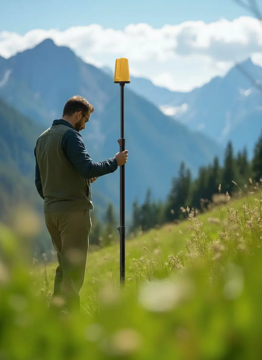
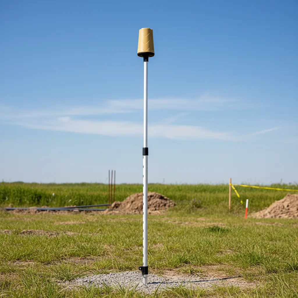
Multi-Constellation RTK GNSS Receiver
ProTRACK is the multi-constellation RTK GNSS receiver designed for professionals who demand reliability, speed, and portability. FIX RTK in a few seconds, 18h of battery life, Bluetooth and Wi-Fi connection.
1 cm
RTK precision
18h
Autonomy
< 3s
FIX time

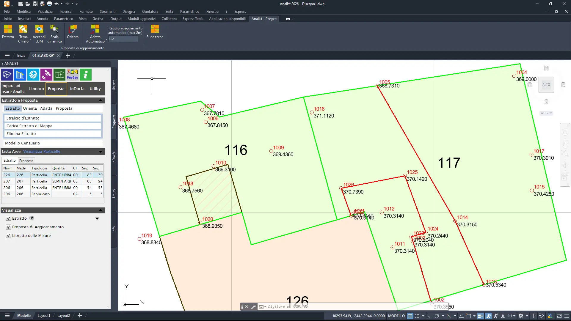
PREGEO Automatic and Cadastral Surveys
ProTRACK is an integrated GPS + Android smartphone + Analist Desktop software solution that allows any technician — expert or novice — to complete cadastral procedures quickly and easily, without instrument training.
Detect
Instant boot, automatic setup, a few essential features on Android smartphones. No course necessary.
Transfer
Send the file to the PC via WhatsApp or email. No cables, no physical connections.
Process
Analist Desktop imports the file and guides the technician with a step-by-step wizard — regulatory checks, PREGEO compilation, automatic error checking. The result is ready for the Land Registry.
GPS RTK Workflow: from the Field to the Office with Software Included
ProTRACK + Analist Mobile + Analist CLOUD: three tools, one integrated flow
GPS ProTRACK
On the Field
Detect points with RTK centimeter precision. Multi-constellation, FIX in seconds.
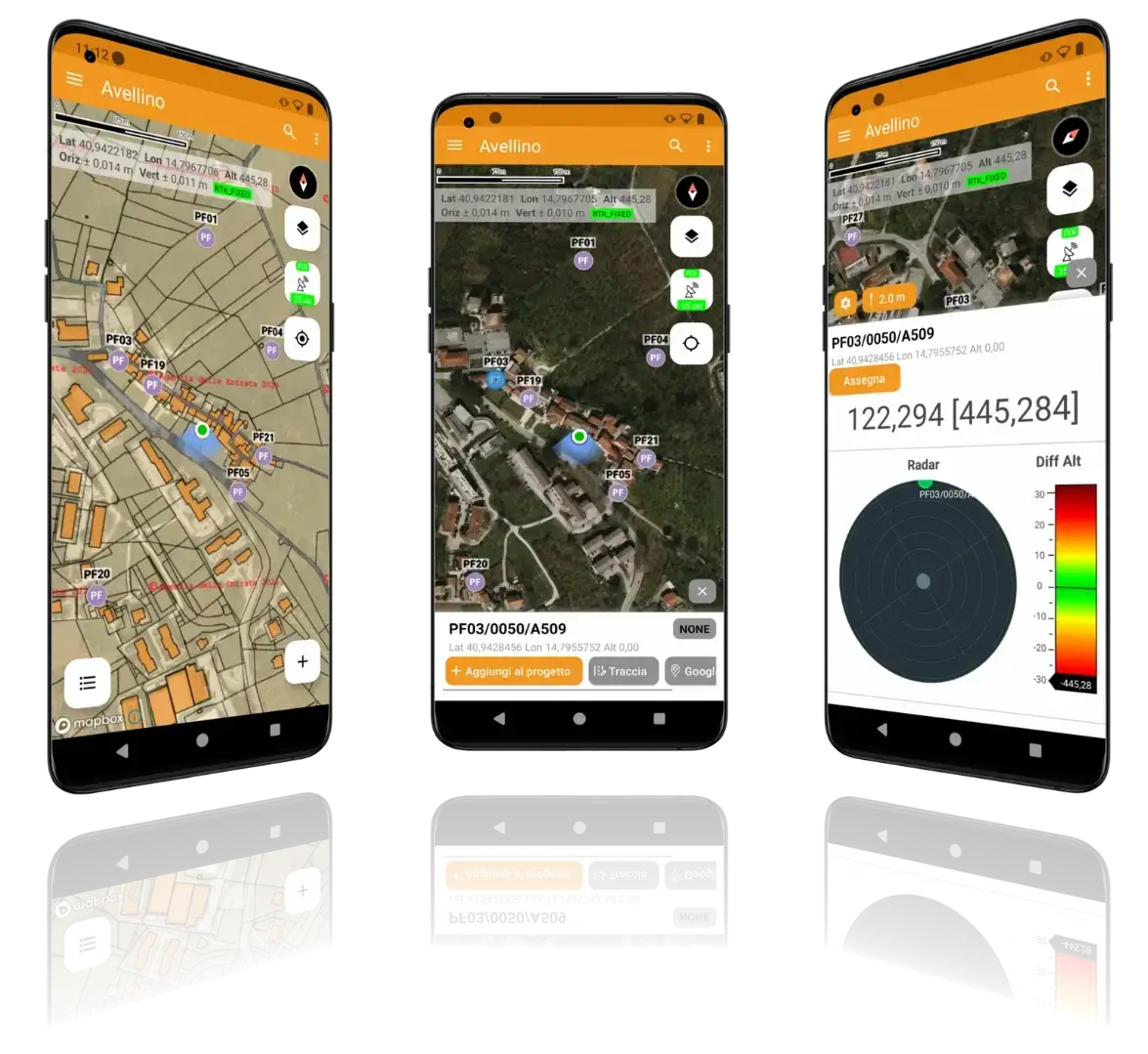
Analist Mobile
In App
Visualize, draw and organize field data. Export to DXF, CSV, SHP.

Analist 2026 CLOUD
In the Office
Elaborate, design and share. Powered by Autodesk Technology.
Analist Mobile
From the field to the map in one touch. Connect to the ProTRACK GPS via Bluetooth, survey points, draw geometry and export everything in standard formats — without returning to the office.
Real-time centimeter measurement
Customizable layers and codes
Export DXF, CSV, SHP instant
Automatic Cloud synchronization
Analist 2026 CLOUD
The surveying software powered by Autodesk Technology that transforms your surveys into professional technical documents — 3D models, cadastral documents, volume calculations, and cloud sharing. Perfectly integrated with the ProTRACK RTK GPS GNSS.
Templates 3D
DTM, DSM, and automatic triangulation from data acquired with ProTRACK GPS and drones. Generate georeferenced digital terrain models with RTK centimeter accuracy — from field to 3D in just a few clicks.
Level curves
Longitudinal profiles, sections cross-sections and dimensioned planes automatically generated from ProTRACK surveys and point clouds. Processing ready for delivery, directly in a CAD environment powered with Autodesk Technology.
Volume Calculation
Excavation, filling, leveling, and construction progress calculated in one click. Compare surfaces over time to monitor construction sites, quarries, and earthworks — with centimeter-level RTK data acquired by ProTRACK, drones, or laser scanners.
Pregeo
Compliant cadastral booklet and Update Proposal filled in automatically. Import Pregeo celerimetric, GPS and mixed booklets directly from ProTRACK surveys with the Analist Mobile App — from the field to the Land Registry without intermediate steps.
Point Clouds
Import and manage point clouds from drones, laser scanners, and Matterport Pro3. Extract plans, elevations and sections, all georeferenced with ProTRACK for 3D models and Digital Twin of absolute precision.
Teamwork
Share projects, progress, and data with your team in real time with Analist PLUS and the Cloud. From acquisition in the field with ProTRACK to return to the office: a single workflow, accessible anywhere.
What our customers say
Toni ViMaX
CEO — VIMAX3D60, Barcelona
"ProTRACK GPS was the best upgrade for our company in 2025. The acquisition of control points, tracks and coordinates UTM for RTK laser scanning and drone projects just got a lot easier."
Amedeo Falcone
Surveyor — Technical Office, Italy
"I use ProTRACK for both cadastral and topographic surveys. In a very short time, I can perform the survey, transfer the data in CAD and carry out tracing and checks on site."
Valentino Sosio
Geologist / Drone Pilot — Italy
"I use ProTRACK for GCP acquisition in areas accessible only by foot, such as glaciers and landslide zones. The combination of compactness and lightness is crucial."
Luca Luchetta
Geodetic Engineer - Studio Tecnico Luchetta
"With ProTRACK we have halved the time for topographic surveys. The stability of the FIX even in dense urban areas is impressive — no other system offers this reliability."
The Professional RTK GPS
Made in Italy
Professional GNSS technology that makes complex surveys simple, fast and precise
EVERYWHERE
ProTRACK guarantees reliability in any location, even without network coverage. Thanks to advanced RTK corrections via NTRIP/TCP, it offers centimeter precision.
FAST
FIX in seconds thanks to multi-constellation support: GPS, Galileo, GLONASS, BeiDou with L1/L2/L5 bands. Maximum efficiency in the field.
SIMPLE
Easy to use for surveyors, engineers, agronomists, and technicians. Seamless integration with the Analist Mobile App for any type of project.
The complete solution for your survey
ProTRACK + solution Analyst
€1,950 + VAT
Even in convenient interest-free installments
- GPS ProTRACK
- Analist 2026 CLOUD — Annual License
- Analist Mobile App
- Case for ProTRACK
- ProTRACK Academy Access
- Assistance and Dedicated Support