Analist CLOUD 2026
The professional software for topography, cadastre, and territorial planning
Analist CLOUD is the professional software suite that covers the entire technical workflow: from field surveying with ProTRACK GNSS RTK to cartographic restitution, from cadastral management to design and photogrammetry from Drone. Modular, scalable, and fully integrated, it's the choice of over 200,000 customers in Europe, the result of more than 30 years of experience in Italian technical software.
Cadastre and cadastral practices
Management of Pregeo and Docfa practices
- Integrated Pregeo 10 and Docfa 4
- Automated land registry types and subdivisions
- Management and editing of Pregeo booklets
- Transformation of geographic and cadastral coordinates
- Updated and compatible cadastral cartography
- Integration with inDocfa for simplified DOCFA procedures
- Automatic import and export of booklets
- Timely management of fiducial points
- Integration with TAF (fiducial points and monographic sheets) and DIS (mutual distances)
- Management of fiducial points and PF
Topography and surveying
GNSS and total station data processing with network adjustments, measurement logs, coordinate calculation, and cartographic output. Native integration with ProTRACK GNSS RTK for a seamless workflow from the field to the office.
- Network and polygon adjustments
- Measurement logs and coordinate calculations
- CAD cartographic output
- Direct import from ProTRACK GNSS RTK
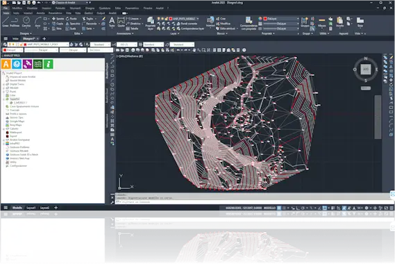
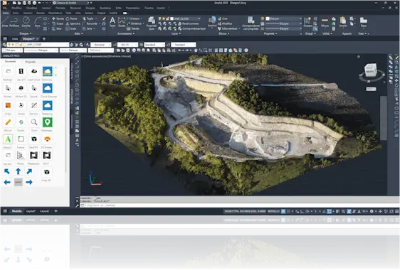
- 3D terrain model generation from data acquired with drones, GPS, and topographic instruments
- Advanced management of quarries, leveling, and cut/fill volumes
- Automatic creation of profiles, cross-sections, and contour lines
- Surface import from Google Maps, Bing Maps, Tinitaly, and other DSM/DTM services
- Integration with E57 point clouds
- Optimized workflow for precision topographic surveys
- Monitoring of Landslides and Subsidences, Ridges, and Excavations through Volume Calculation, Quarry or Excavation Progress
Agriculture Precision
Data processing for plot mapping, area calculation, parcel management, elevations, and leveling for irrigation optimization. Complete integration with high-precision GNSS surveys via ProTRACK.
- Area and perimeter calculations
- Elevations and leveling for irrigation
- Map export for agricultural machinery
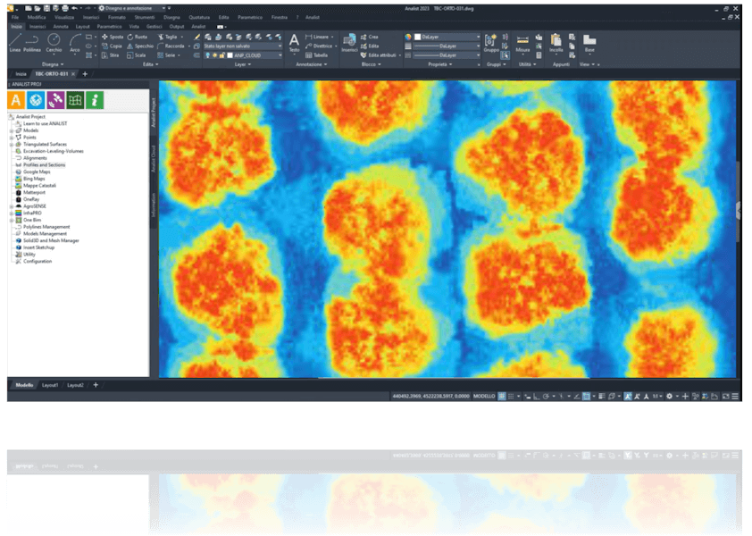
- Get real-time NDVI maps
- Monitor crops and water stress to improve yields
- Integrate analytics into agricultural workflows for sustainable management
Road design
Module dedicated to the design of Road infrastructure: tracing of planimetric and altimetric axes, cross-sections, earthwork calculations and generation of executive documents. Designed for professionals who manage new construction, maintenance, and road upgrade projects.
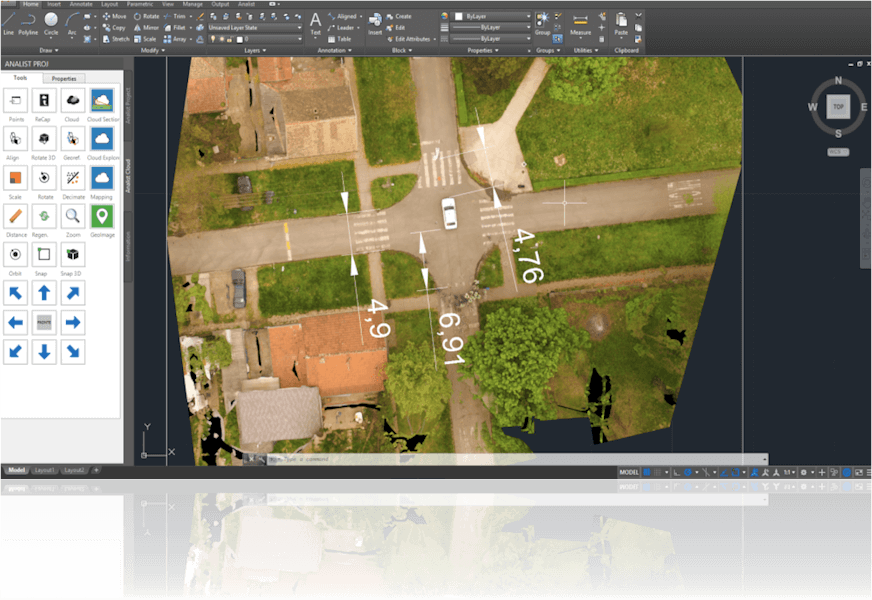
- 3D reconstruction of the accident scene: detailed rendering for analysis and documentation
- Measurements from every angle to calculate distances, trajectories, and impact points